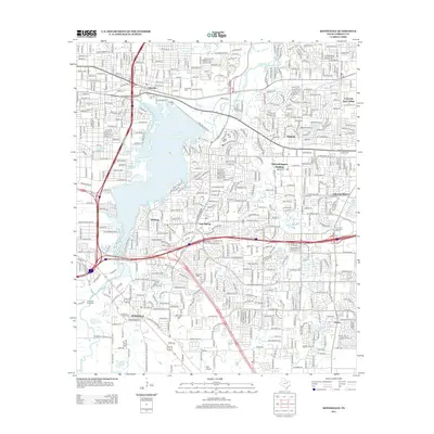
2012 Map of Kennedale
USGS Topo · Published 2012About this map
Lake Arlington dominates the central landscape of this Tarrant County region, surrounded by a dense network of suburban growth and established communities. Significant local history is preserved in the Handley Cem, Tate Cem, and Hawkins Cem, which serve as anchors for the older residential clusters of Handley and Tate Springs. The northern edge is defined by the Union Pacific rail corridor, while the southern reaches transition into more open terrain near Murray Hill. This 2012 survey illustrates the intense infill of the Fort Worth-Arlington corridor, where institutional landmarks like the Arlington Baptist Coll and commercial hubs such as The Parks at Arlington sit alongside specialized sites like the Forest Hill Drag Strip and the small Birk Airport.
Find a feature on this map
42 named features on this map. Tap any name to fly to it.
Don’t see what you’re looking for? This feature index may not catch every label — zoom into the map to look around manually.
Map Details
Editions of this 2012 Kennedale Map
This is the sole edition of this map. No revisions or reprints were ever made.
Other maps of this area

1894 · Fort Worth
USGS Topo · 1:125,000

1931 · Grapevine
USGS Topo · 1:62,500

1954 · Dallas
USGS Topo · 1:250,000

1955 · Haltom City
USGS Topo · 1:24,000

1955 · Burleson
USGS Topo · 1:24,000

1955 · Fort Worth
USGS Topo · 1:24,000

1955 · Haltom City
USGS Topo · 1:62,500

1958 · Dallas
USGS Topo · 1:250,000

1959 · Kennedale
USGS Topo · 1:24,000

1959 · Arlington
USGS Topo · 1:24,000