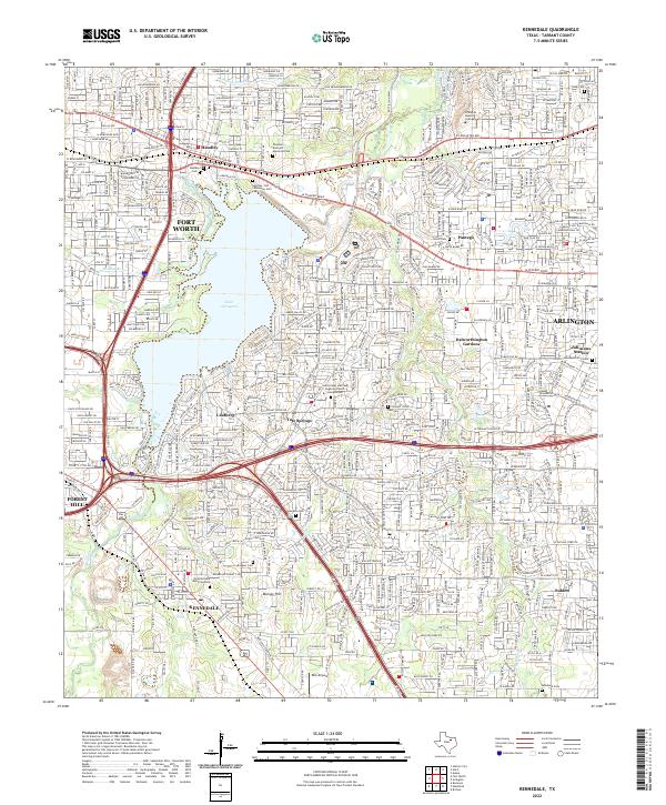
2022 Map of Kennedale
USGS Topo · Published 2022About this map
Lake Arlington dominates the central landscape of this Tarrant County region, surrounded by the suburban development of Fort Worth, Arlington, and Kennedale. The map preserves numerous small family and community burial grounds that predate the modern residential expansion, such as the Noah Cem and Johnson Station Cem. These sites, along with Handley Cem and Tate Cem, provide critical touchpoints for genealogists tracing early North Texas families.
Find a feature on this map
38 named features on this map. Tap any name to fly to it.
Don’t see what you’re looking for? This feature index may not catch every label — zoom into the map to look around manually.
Map Details
Editions of this 2022 Kennedale Map
This is the sole edition of this map. No revisions or reprints were ever made.
Other maps of this area

1894 · Fort Worth
USGS Topo · 1:125,000

1931 · Grapevine
USGS Topo · 1:62,500

1954 · Dallas
USGS Topo · 1:250,000

1955 · Haltom City
USGS Topo · 1:24,000

1955 · Burleson
USGS Topo · 1:24,000

1955 · Fort Worth
USGS Topo · 1:24,000

1955 · Haltom City
USGS Topo · 1:62,500

1958 · Dallas
USGS Topo · 1:250,000

1959 · Kennedale
USGS Topo · 1:24,000

1959 · Arlington
USGS Topo · 1:24,000