
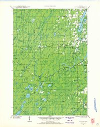
1941 Map of Kennedy
USGS Topo · Published 1959About this map
The Chicago and Northwestern railroad corridor provides a central axis for this rural landscape, connecting small settlements like Kennedy and Kaiser during the early 1940s. The region is defined by its extensive water network and timber-related infrastructure, featuring the Million Acre Swamp and numerous named fire lookouts such as the Kennedy Fire Tower and Lugerville Fire Tower. Industrial activity is evident along the waterways, where the Pixley Dam and Crowley Dam manage the river's flow, while the Old Mill Dam near Lugerville points to the area's milling history.
Find a feature on this map
84 named features on this map. Tap any name to fly to it.
Don’t see what you’re looking for? This feature index may not catch every label — zoom into the map to look around manually.
Map Details
Editions of this 1941 Kennedy Map
2 editions found
Other maps of this area

1940 · Butternut
USGS Topo · 1:48,000

1941 · Park Falls
USGS Topo · 1:48,000

1941 · Kennan
USGS Topo · 1:48,000

1941 · Phillips
USGS Topo · 1:48,000

1942 · Glidden
USGS Topo · 1:48,000

1942 · Clam Lake
USGS Topo · 1:48,000

1943 · Park Falls
USGS Topo · 1:48,000

1943 · Philliips
USGS Topo · 1:48,000

1944 · Draper
USGS Topo · 1:48,000

1945 · Kennedy
USGS Topo · 1:48,000