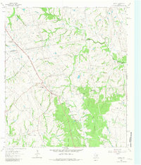
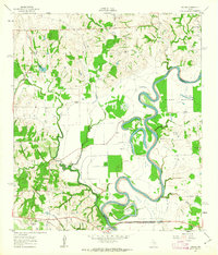
1963 Map of Kenney
USGS Topo · Published 1981About this map
The boundary between Washington and Austin counties bisects this mid-century landscape, dominated by the winding course of the Gulf Colorado and Santa Fe railroad. The settlement of Kenney serves as a central hub, while the nearby Kenney-New Welcome label suggests a specific local neighborhood or developmental shift during the early 1960s. The area is heavily defined by family-named landmarks and rural infrastructure, including Gilbert Chapel and the Elm Sch, which anchored the social life of these agricultural communities.
Find a feature on this map
30 named features on this map. Tap any name to fly to it.
Don’t see what you’re looking for? This feature index may not catch every label — zoom into the map to look around manually.
Map Details
Editions of this 1963 Kenney Map
Other maps of this area

1930 · Brenham
USGS Topo · 1:62,500

1953 · Seguin
USGS Topo · 1:250,000

1954 · Austin
USGS Topo · 1:250,000

1956 · Bellville
USGS Topo · 1:62,500

1956 · Sealy
USGS Topo · 1:62,500

1956 · Hempstead
USGS Topo · 1:62,500

1956 · Brenham
USGS Topo · 1:62,500

1958 · Seguin
USGS Topo · 1:250,000
1961 · Burleigh
USGS Topo · 1:24,000
1961 · Daniels
USGS Topo · 1:24,000