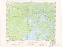
1963 Map of Kenora
USGS Topo · Published 1976About this map
Lake of the Woods dominates this international boundary region, where the intricate shorelines of the Aulneau Peninsula and Western Peninsula create a complex geography of bays and islands. The city of Kenora and neighboring Keewatin serve as the primary hubs along the northern reach of the lake, situated near where the Winnipeg River drains the basin. To the west, the landscape transitions from the dense waters of the lake to the protected reaches of the Northwest Angle Forest Reserve and the Sandilands Forest Reserve. This 1963 survey captures a transit-heavy wilderness, with the Canadian Pacific and Canadian National railroads moving through remote settlements like Hoctor and Telford. The Greater Winnipeg Water District Railway cuts a distinct path toward the city of Winnipeg, highlighting the era's reliance on rail for resource management and regional connectivity across the Manitoba-Ontario-Minnesota borders.
Find a feature on this map
66 named features on this map. Tap any name to fly to it.
Don’t see what you’re looking for? This feature index may not catch every label — zoom into the map to look around manually.
Map Details
Editions of this 1963 Kenora Map
2 editions found

Other maps of this area

1918 · Goos
USGS Topo · 1:62,500

1918 · Buffalo Bay
USGS Topo · 1:62,500

1918 · Roosevelt
USGS Topo · 1:62,500
1918 · Oak Island
USGS Topo · 1:62,500

1918 · Williams
USGS Topo · 1:62,500

1918 · Roseau
USGS Topo · 1:62,500

1918 · Warroad
USGS Topo · 1:62,500

1919 · Canada
USGS Topo · 1:62,500

1919 · Badger
USGS Topo · 1:62,500

1943 · Roosevelt
USGS Topo · 1:62,500