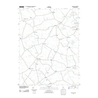
2011 Map of Kenton
USGS Topo · Published 2011About this map
The town of Kenton and the nearby Hartly post office serve as central nodes in this Delaware landscape defined by a intricate system of agricultural drainage. The terrain is crisscrossed by an extensive network of waterways including Sewell Branch, Jordan Branch, and Gravelly Run, many of which have been modified into channelized features like Blanco Ditch and Tappahanna Ditch. This reliance on water management is essential to the region's agricultural productivity, supporting facilities such as the Delaware State College Farm.
Find a feature on this map
70 named features on this map. Tap any name to fly to it.
Don’t see what you’re looking for? This feature index may not catch every label — zoom into the map to look around manually.
Map Details
Editions of this 2011 Kenton Map
This is the sole edition of this map. No revisions or reprints were ever made.
Other maps of this area

1899 · Dover
USGS Topo · 1:125,000

1900 · Cecilton
USGS Topo · 1:62,500

1905 · Barclay
USGS Topo · 1:62,500

1906 · Dover
USGS Topo · 1:125,000

1920 · Dover
USGS Topo · 1:125,000

1926 · Wyoming
USGS Topo · 1:48,000

1930 · Wyoming
USGS Topo · 1:62,500

1931 · Wyoming
USGS Topo · 1:62,500

1931 · Smyrna
USGS Topo · 1:62,500
1944 · Goldsboro
USGS Topo · 1:31,680