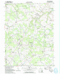
1993 Map of Kenton
USGS Topo · Published 1993About this map
The Kenton quadrangle along the Maryland Delaware border is defined by a network of historic rural crossroads and agricultural land. In the early 1990s, these small settlements, including Underwood Corner, Everetts Corner, and Wrights Crossroads, maintained a pattern of life centered on country churches like Kenton Ch and the historic Bryn Zion Cem. Water systems dominate the northern reaches, where the Leipsic River flows from Masseys Millpond and a Gaging Station monitors the local hydrology.
Find a feature on this map
90 named features on this map. Tap any name to fly to it.
Don’t see what you’re looking for? This feature index may not catch every label — zoom into the map to look around manually.
Map Details
Editions of this 1993 Kenton Map
This is the sole edition of this map. No revisions or reprints were ever made.
Other maps of this area

1899 · Dover
USGS Topo · 1:125,000

1900 · Cecilton
USGS Topo · 1:62,500

1905 · Barclay
USGS Topo · 1:62,500

1906 · Dover
USGS Topo · 1:125,000

1920 · Dover
USGS Topo · 1:125,000

1926 · Wyoming
USGS Topo · 1:48,000

1930 · Wyoming
USGS Topo · 1:62,500

1931 · Wyoming
USGS Topo · 1:62,500

1931 · Smyrna
USGS Topo · 1:62,500
1944 · Goldsboro
USGS Topo · 1:31,680