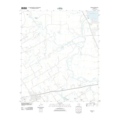
2010 Map of Kerens
USGS Topo · Published 2010About this map
The Trinity River dominates this landscape as it meanders through East Texas, creating complex oxbows and secondary water bodies such as Horseshoe Bend, Round Lake, and Singletary Lake. To the north, the Bazette Oil Field indicates the region's industrial ties, while the southeastern corner is defined by the expansive Cedar Creek Reservoir. The town of Kerens serves as the primary settlement, with its grid of streets concentrated near Cemetery Creek and the Kerens Cemetery.
Find a feature on this map
38 named features on this map. Tap any name to fly to it.
Don’t see what you’re looking for? This feature index may not catch every label — zoom into the map to look around manually.
Map Details
Editions of this 2010 Kerens Map
This is the sole edition of this map. No revisions or reprints were ever made.
Other maps of this area

1920 · Kemp
USGS Topo · 1:62,500

1954 · Dallas
USGS Topo · 1:250,000

1957 · Kemp
USGS Topo · 1:62,500

1958 · Dallas
USGS Topo · 1:250,000

1959 · Powell
USGS Topo · 1:24,000

1960 · Tool
USGS Topo · 1:24,000

1960 · Mabank
USGS Topo · 1:24,000

1960 · Creslenn Ranch
USGS Topo · 1:24,000

1960 · Goodlow Park
USGS Topo · 1:24,000

1960 · Malakoff
USGS Topo · 1:24,000