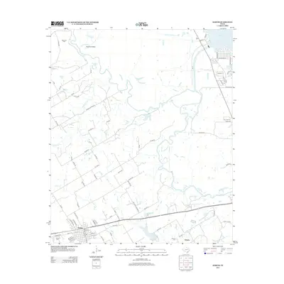
2012 Map of Kerens
USGS Topo · Published 2012About this map
Kerens serves as the primary hub in this eastern Texas landscape, where the town grid meets the winding course of the Trinity River. The river forms a complex network of oxbows and secondary water bodies such as Horseshoe Bend, Round Lake, and Singletary Lake, illustrating the dynamic nature of the bottomlands. To the north, the massive Cedar Cr Reservoir dominates the horizon, while the Bazette Oil Field indicates the industrial footprint of the region's energy resources. Local heritage is grounded in sites like the Kerens Cem and the Samarie Cem near the small settlement of Samaria. The terrain is crisscrossed by numerous seasonal waterways including Humphries Cr, Indian Cr, and Cow Cr, which drain into the river basin. The infrastructure around Kerens City Lake and the various county roads like Oak Grove Cemetery Rd suggest a community closely tied to its rural land and water management.
Find a feature on this map
76 named features on this map. Tap any name to fly to it.
Don’t see what you’re looking for? This feature index may not catch every label — zoom into the map to look around manually.
Map Details
Editions of this 2012 Kerens Map
This is the sole edition of this map. No revisions or reprints were ever made.
Other maps of this area

1920 · Kemp
USGS Topo · 1:62,500

1954 · Dallas
USGS Topo · 1:250,000

1957 · Kemp
USGS Topo · 1:62,500

1958 · Dallas
USGS Topo · 1:250,000

1959 · Powell
USGS Topo · 1:24,000

1960 · Tool
USGS Topo · 1:24,000

1960 · Mabank
USGS Topo · 1:24,000

1960 · Creslenn Ranch
USGS Topo · 1:24,000

1960 · Goodlow Park
USGS Topo · 1:24,000

1960 · Malakoff
USGS Topo · 1:24,000