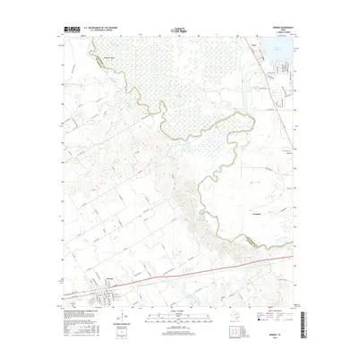
2016 Map of Kerens
USGS Topo · Published 2016About this map
The Trinity River defines the landscape of the Texas borderlands between Henderson and Navarro counties, winding through a complex network of wetlands and oxbows. Near Horseshoe Bend, the river is flanked by numerous water bodies like Round Lake and Singletary Lake, illustrating the shifting course of the waterway over time. To the south, the settlement of Kerens serves as a local hub, featuring the Kerens Cem and the Kerens City Lake, while the town of Trinidad sits further east along the riverbank. This 2016 survey captures the area during a period of modern residential growth, particularly in the community of Tool near the shores of Cedar Cr Reservoir. Researchers can trace the development of local infrastructure through named routes such as Morgan Springs Rd and a dense network of residential streets that now line the reservoir's edge, contrasting with the more rural, open terrain found near Samarie Cem.
Find a feature on this map
93 named features on this map. Tap any name to fly to it.
Don’t see what you’re looking for? This feature index may not catch every label — zoom into the map to look around manually.
Map Details
Editions of this 2016 Kerens Map
This is the sole edition of this map. No revisions or reprints were ever made.
Other maps of this area

1920 · Kemp
USGS Topo · 1:62,500

1954 · Dallas
USGS Topo · 1:250,000

1957 · Kemp
USGS Topo · 1:62,500

1958 · Dallas
USGS Topo · 1:250,000

1959 · Powell
USGS Topo · 1:24,000

1960 · Tool
USGS Topo · 1:24,000

1960 · Mabank
USGS Topo · 1:24,000

1960 · Creslenn Ranch
USGS Topo · 1:24,000

1960 · Goodlow Park
USGS Topo · 1:24,000

1960 · Malakoff
USGS Topo · 1:24,000