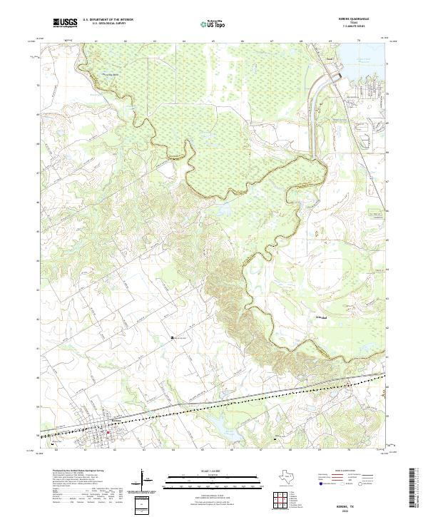
2022 Map of Kerens
USGS Topo · Published 2022About this map
The Trinity River snakes through the bottomlands of the Navarro and Henderson County line, defining a landscape of oxbows and riparian wetlands. The river's meandering history is etched into the terrain at Horseshoe Bend and the nearby Round Lake, while the modern shoreline of the Cedar Creek Reservoir dominates the northeastern corner. In the south, the city of Kerens serves as a local hub, situated near the Kerens City Lake and several prominent burial grounds including Kerens Cem and Oak Grove Cem.
Find a feature on this map
93 named features on this map. Tap any name to fly to it.
Don’t see what you’re looking for? This feature index may not catch every label — zoom into the map to look around manually.
Map Details
Editions of this 2022 Kerens Map
This is the sole edition of this map. No revisions or reprints were ever made.
Other maps of this area

1920 · Kemp
USGS Topo · 1:62,500

1954 · Dallas
USGS Topo · 1:250,000

1957 · Kemp
USGS Topo · 1:62,500

1958 · Dallas
USGS Topo · 1:250,000

1959 · Powell
USGS Topo · 1:24,000

1960 · Tool
USGS Topo · 1:24,000

1960 · Mabank
USGS Topo · 1:24,000

1960 · Creslenn Ranch
USGS Topo · 1:24,000

1960 · Goodlow Park
USGS Topo · 1:24,000

1960 · Malakoff
USGS Topo · 1:24,000