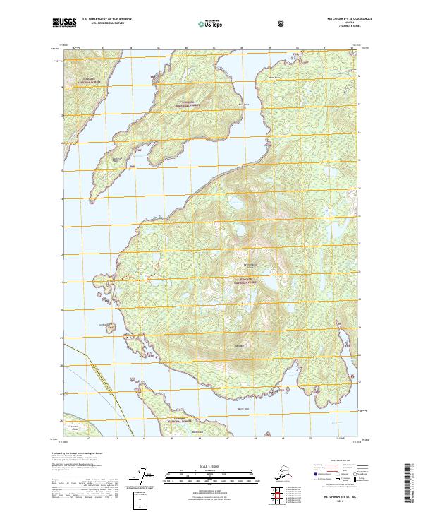
2021 Map of Ketchikan B-5 SE
USGS Topo · Published 2021About this map
Revillagigedo Island dominates this coastal landscape within the Tongass National Forest, showcasing the intricate waterways and maritime boundaries of Southeast Alaska. The map traces the rugged coastline from California Head and California Cove in the north down to the southern reaches near Bold Island. A significant administrative divide is marked by the Ketchikan Gateway Borough Prince of Wales-Hyder Census Area boundary, which cuts through the waters of Thorne Arm.
Find a feature on this map
27 named features on this map. Tap any name to fly to it.
Don’t see what you’re looking for? This feature index may not catch every label — zoom into the map to look around manually.
Map Details
Editions of this 2021 Ketchikan B-5 SE Map
This is the sole edition of this map. No revisions or reprints were ever made.
Other maps of this area

1949 · Ketchikan B-4
USGS Topo · 1:63,360

1952 · Ketchikan
USGS Topo · 1:250,000

1952 · Ketchikan B-4
USGS Topo · 1:63,360

1954 · Ketchikan B-5
USGS Topo · 1:63,360

1955 · Ketchikan A-4
USGS Topo · 1:63,360

1955 · Ketchikan A-5
USGS Topo · 1:63,360

1955 · Ketchikan
USGS Topo · 1:250,000

1955 · Ketchikan B-5
USGS Topo · 1:63,360
1991 · Ketchikan B-5 SW
USGS Topo · 1:25,000
1991 · Ketchikan B-5 NW
USGS Topo · 1:25,000