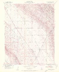
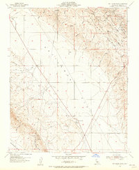
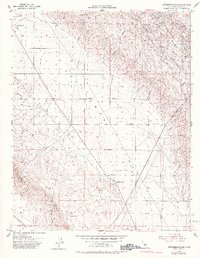
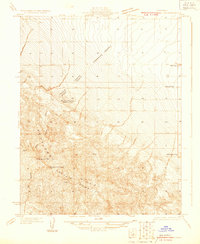
1953 Map of Kettleman Plain
USGS Topo · Published 1956About this map
The Kettleman Plain and the eastern flanks of Reef Ridge define this mid-century landscape of oil exploration and agricultural expansion. Mapping reflects a period of transition, with Oil Wells (Abandoned) scattered near Drillers Ridge and Bullwheel Ridge, signaling the early industrial footprint on the Kettleman Hills. The presence of small settlements like El Dombo, El Loro, and La Oveja suggests early rural outposts, while infrastructure such as Skyline Road and a Landing Strip indicate the area's integration into the regional transport network.
Find a feature on this map
42 named features on this map. Tap any name to fly to it.
Don’t see what you’re looking for? This feature index may not catch every label — zoom into the map to look around manually.
Map Details
Editions of this 1953 Kettleman Plain Map
4 editions found

Other maps of this area

1912 · Coalinga
USGS Topo · 1:125,000

1914 · Lost Hills
USGS Topo · 1:125,000

1914 · Cholame
USGS Topo · 1:125,000

1915 · Cholame
USGS Topo · 1:125,000

1917 · Cholame
USGS Topo · 1:125,000
1930 · Discovery Well
USGS Topo · 1:31,680

1930 · Avenal Gap
USGS Topo · 1:31,680

1930 · Canoas Creek
USGS Topo · 1:31,680

1930 · Kettleman Plain
USGS Topo · 1:31,680

1930 · Middle Dome
USGS Topo · 1:31,680