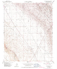
1953 Map of Kettleman Plain
USGS Topo · Published 1983About this map
Kettleman Dome dominates the northeastern landscape of this mid-century survey, a topographical high point marked by intensive resource extraction as evidenced by numerous oil wells. This industrial activity contrasts with the broad, open drainage of the Kettleman Plain and the complex system of arroyos, such as Arroyo Mellado and Arroyo Paso, that carve through the hills. Small outposts and named locales including El Dambo, El Loro, and Reef Station serve as early markers of human settlement in this arid environment.
Find a feature on this map
40 named features on this map. Tap any name to fly to it.
Don’t see what you’re looking for? This feature index may not catch every label — zoom into the map to look around manually.
Map Details
Editions of this 1953 Kettleman Plain Map
4 editions found
Other maps of this area

1912 · Coalinga
USGS Topo · 1:125,000

1914 · Lost Hills
USGS Topo · 1:125,000

1914 · Cholame
USGS Topo · 1:125,000

1915 · Cholame
USGS Topo · 1:125,000

1917 · Cholame
USGS Topo · 1:125,000

1930 · Discovery Well
USGS Topo · 1:31,680

1930 · Avenal Gap
USGS Topo · 1:31,680

1930 · Canoas Creek
USGS Topo · 1:31,680

1930 · Kettleman Plain
USGS Topo · 1:31,680

1930 · Middle Dome
USGS Topo · 1:31,680