2022 Map of Keystone Dam
USGS Topo · Published 2022About this map
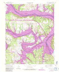
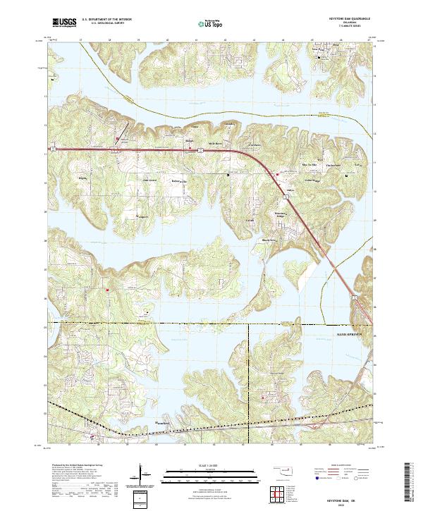
Keystone Lake dominates this 2022 topographical layout, where the Arkansas River carve through a landscape of dramatic peninsulas and ridges at the intersection of Osage, Pawnee, Creek, and Tulsa counties. The map captures the complex shoreline and residential developments that define modern water-oriented communities like Westport, Mannford, and Prue. Genealogists will find several burial sites preserved amidst the residential growth, including Prairie View Cem, Dixie Cem, and East Basin Cem, which serve as quiet anchors to the region's history before and after the reservoir's creation. Small named settlements and neighborhood clusters such as Peterman Ridge, Calida, and Baugh are shown connected by a network of local roads like Scenic Rd and Peninsula Dr. The presence of the Westport Airport and proximity to Sand Springs highlight the area's role as a recreation and transport hub in northeastern Oklahoma.
Find a feature on this map
126 named features on this map. Tap any name to fly to it.
Don’t see what you’re looking for? This feature index may not catch every label — zoom into the map to look around manually.
Map Details
Editions of this 2022 Keystone Dam Map
This is the sole edition of this map. No revisions or reprints were ever made.
Historical Maps of Empy Through Time
10 maps found