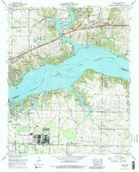
1971 Map of Killen
USGS Topo · Published 1991About this map
The Tennessee River divides this North Alabama landscape, where the waters of Wilson Lake back into the deep inlets of Shoal Creek and Brush Creek. Following the 1968 Tennessee Valley Authority revision, the map reveals a transition between the established agricultural uplands of Lauderdale Co and the industrial corridors of Colbert Co to the south. The area around Listerhill and Nitrate City shows the significant industrial footprint near the river, including extensive settling ponds and the Southern RR lines that supported the local economy. North of the river, the residential expansion of Killen and waterfront developments like Lauderdale Beach and Emerald Shores contrast with older rural landmarks. Genealogists will find numerous family burial grounds, including Tate-Russell Cem, Jones Hill Cem, and Hawkins Cem, alongside community anchors like Brooks Sch and Mt Zion Ch.
Find a feature on this map
65 named features on this map. Tap any name to fly to it.
Don’t see what you’re looking for? This feature index may not catch every label — zoom into the map to look around manually.
Map Details
Editions of this 1971 Killen Map
3 editions found
Other maps of this area

1914 · Rogersville
USGS Topo · 1:48,000

1914 · Muscle Shoals
USGS Topo · 1:48,000

1916 · Muscle Shoals
USGS Topo · 1:62,500

1916 · Rogersville
USGS Topo · 1:62,500

1924 · Tuscumbia
USGS Topo · 1:48,000

1926 · Tuscumbia
USGS Topo · 1:62,500

1936 · Pruitton
USGS Topo · 1:24,000

1936 · Wheeler Dam
USGS Topo · 1:24,000

1936 · Florence
USGS Topo · 1:24,000

1936 · Town Creek
USGS Topo · 1:24,000