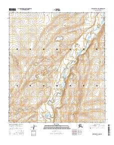
2016 Map of Killik River C-2 NE
USGS Topo · Published 2016About this map
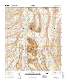
Killik River serves as the dominant geographical artery through this North Slope landscape, cutting a braided path through the surveyed sections of t9s r8w and t8s r7w. The hydrography of the river valley is complex, characterized by numerous small oxbows and marshy wetlands that suggest a highly dynamic fluvial environment within the Arctic drainage. These waters wind between high-elevation ridges, with contour intervals revealing steep climbs into the neighboring townships of t8s r8w and t9s r7w. This 2016 survey, grounded in data from the National Hydrography Dataset and National Elevation Dataset, provides a technical baseline of a remote river corridor before the impacts of shifting permafrost and northern climate changes further alter the drainage patterns and shoreline morphology of this wilderness region.
Find a feature on this map
6 named features on this map. Tap any name to fly to it.
Don’t see what you’re looking for? This feature index may not catch every label — zoom into the map to look around manually.
Map Details
Editions of this 2016 Killik River C-2 NE Map
This is the sole edition of this map. No revisions or reprints were ever made.
Other maps of this area

1951 · Killik River
USGS Topo · 1:250,000

1956 · Killik River
USGS Topo · 1:250,000
1984 · Killik River D-2
USGS Topo · 1:63,360
1986 · Killik River C-2
USGS Topo · 1:63,360
1986 · Killik River D-1
USGS Topo · 1:63,360
1986 · Killik River C-1
USGS Topo · 1:63,360
2016 · Killik River D-2 SE
USGS Topo · 1:25,000
2016 · Killik River C-2 SW
USGS Topo · 1:25,000
2016 · Killik River C-2 SE
USGS Topo · 1:25,000
2016 · Killik River C-1 SW
USGS Topo · 1:25,000