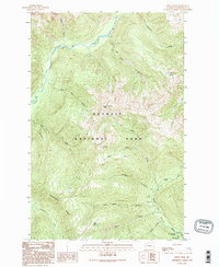
1990 Map of Kimta Peak
USGS Topo · Published 1995About this map
Kimta Peak stands as the central topographic anchor of this high-elevation landscape within Olympic National Park. The survey illustrates the complex watershed divide between the Queets River to the north and the North Fork Quinault River to the south. Several small, high mountain lakes including Lake Beauty and Kurtz Lake are tucked into the steep drainages, providing a detailed look at the drainage patterns of tributaries with distinctive local names such as Hee Haw Creek and Hee Hee Creek.
Find a feature on this map
24 named features on this map. Tap any name to fly to it.
Don’t see what you’re looking for? This feature index may not catch every label — zoom into the map to look around manually.
Map Details
Editions of this 1990 Kimta Peak Map
2 editions found
Other maps of this area

1935 · Mount Olympus
USGS Topo · 1:62,500

1939 · Mount Tom
USGS Topo · 1:62,500

1942 · Mount Olympus
USGS Topo · 1:62,500

1947 · Mt Christie
USGS Topo · 1:62,500

1950 · Mt Christie
USGS Topo · 1:62,500

1956 · Mount Olympus
USGS Topo · 1:62,500

1956 · Kloochman Rock
USGS Topo · 1:62,500

1956 · Mount Tom
USGS Topo · 1:62,500
1957 · Mount Tom
USGS Topo · 1:62,500

1958 · Seattle
USGS Topo · 1:250,000