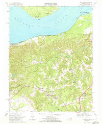
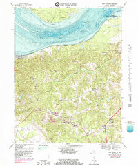
1968 Map of King George
USGS Topo · Published 1972About this map
The Potomac River dominates the northern landscape of this Virginia-Maryland border region, where the state line follows the winding shoreline between Maryland Point and Metomkin Point. Along the southern banks, the community of Fairview Beach and the seasonal retreats at Wellington Beach and Somerset Beach reflect the river's influence on local settlement. Inland, the seat of King George sits at the junction of primary roads, supported by a network of rural hamlets including Comorn, Ambar, and Weedonville. This 1960s-era landscape is characterized by its agricultural and maritime history, evident in the numerous small country churches like Peoples Union Ch and St Stephens Ch. The presence of an Abandoned Mill on Pepper Creek and the Mason Millpond along Upper Machodoc Creek points to earlier water-powered industry that once defined the economy of the Tidewater interior before modern thoroughfares redirected local growth.
Find a feature on this map
44 named features on this map. Tap any name to fly to it.
Don’t see what you’re looking for? This feature index may not catch every label — zoom into the map to look around manually.
Map Details
Editions of this 1968 King George Map
5 editions found
Other maps of this area

1889 · Fredericksburg
USGS Topo · 1:125,000

1892 · Fredericksburg
USGS Topo · 1:125,000

1894 · Fredericksburg
USGS Topo · 1:125,000

1913 · Nanjemoy
USGS Topo · 1:62,500

1926 · Stafford
USGS Topo · 1:62,500

1931 · Stafford
USGS Topo · 1:62,500

1942 · Rollins Fork
USGS Topo · 1:31,680

1942 · Port Royal
USGS Topo · 1:31,680

1942 · Rappahannock Academy
USGS Topo · 1:31,680
1944 · Widewater
USGS Topo · 1:31,680