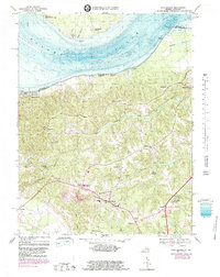
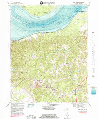
1968 Map of King George
USGS Topo · Published 1983About this map
Potomac River shorelines define the northern edge of this coastal Virginia landscape, where the boundary between Maryland and Virginia follows the winding river channel. This survey documents the transition from waterfront recreational areas like Fairview Beach and Wellington Beach to the interior agricultural and institutional hub of King George. The map includes significant military and scientific infrastructure, notably the Naval Research Lab Maryland Point Antenna Range situated near Maryland Point.
Find a feature on this map
47 named features on this map. Tap any name to fly to it.
Don’t see what you’re looking for? This feature index may not catch every label — zoom into the map to look around manually.
Map Details
Editions of this 1968 King George Map
5 editions found
Other maps of this area

1889 · Fredericksburg
USGS Topo · 1:125,000

1892 · Fredericksburg
USGS Topo · 1:125,000

1894 · Fredericksburg
USGS Topo · 1:125,000

1913 · Nanjemoy
USGS Topo · 1:62,500

1926 · Stafford
USGS Topo · 1:62,500

1931 · Stafford
USGS Topo · 1:62,500

1942 · Rollins Fork
USGS Topo · 1:31,680

1942 · Port Royal
USGS Topo · 1:31,680

1942 · Rappahannock Academy
USGS Topo · 1:31,680
1944 · Widewater
USGS Topo · 1:31,680