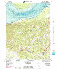
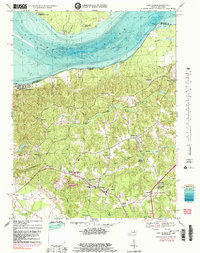
1968 Map of King George
USGS Topo · Published 1985About this map
The Potomac River dominates this northern Virginia landscape, its wide channel and detailed bathymetry marking the boundary between Maryland and Virginia. Along the southern banks, the community of King George serves as the focal point for a network of crossroads settlements and riverfront communities. Notable infrastructure including the Naval Research Lab Maryland Point Antenna Range and several Radio Towers sit across from Fairview Beach, reflecting the region's mid-century military and communication footprint.
Find a feature on this map
42 named features on this map. Tap any name to fly to it.
Don’t see what you’re looking for? This feature index may not catch every label — zoom into the map to look around manually.
Map Details
Editions of this 1968 King George Map
5 editions found
Other maps of this area

1889 · Fredericksburg
USGS Topo · 1:125,000

1892 · Fredericksburg
USGS Topo · 1:125,000

1894 · Fredericksburg
USGS Topo · 1:125,000

1913 · Nanjemoy
USGS Topo · 1:62,500

1926 · Stafford
USGS Topo · 1:62,500

1931 · Stafford
USGS Topo · 1:62,500

1942 · Rollins Fork
USGS Topo · 1:31,680

1942 · Port Royal
USGS Topo · 1:31,680

1942 · Rappahannock Academy
USGS Topo · 1:31,680
1944 · Widewater
USGS Topo · 1:31,680