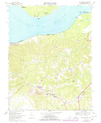
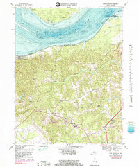
1968 Map of King George
USGS Topo · Published 1978About this map
King George serves as the focal point of this late 1960s survey, illustrating the inland community's layout just before significant late-century development. The map details a landscape transitioning from traditional rural life to a more modern infrastructure, evidenced by the presence of King George High Sch and Bunche High Sch. Along the banks of the Potomac River, riverside communities like Fairview Beach and Wellington Beach highlight the area's maritime orientation, while Stuart Wharf points to a legacy of river-based commerce. The interior is dotted with numerous local landmarks, including Potomac Ch, St Stephens Ch, and Peoples Union Ch, which emphasize the long-standing community centers of the county. Smaller settlements such as Arnolds Corner and Comorn are linked by a network of roads that wind past Mason Millpond and along the drainages of Upper Machodoc Creek.
Find a feature on this map
47 named features on this map. Tap any name to fly to it.
Don’t see what you’re looking for? This feature index may not catch every label — zoom into the map to look around manually.
Map Details
Editions of this 1968 King George Map
5 editions found
Other maps of this area

1889 · Fredericksburg
USGS Topo · 1:125,000

1892 · Fredericksburg
USGS Topo · 1:125,000

1894 · Fredericksburg
USGS Topo · 1:125,000

1913 · Nanjemoy
USGS Topo · 1:62,500

1926 · Stafford
USGS Topo · 1:62,500

1931 · Stafford
USGS Topo · 1:62,500

1942 · Rollins Fork
USGS Topo · 1:31,680

1942 · Port Royal
USGS Topo · 1:31,680

1942 · Rappahannock Academy
USGS Topo · 1:31,680
1944 · Widewater
USGS Topo · 1:31,680