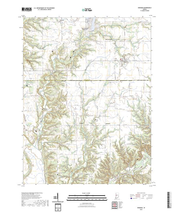
2022 Map of Kingman
USGS Topo · Published 2022About this map
Kingman and Tangier anchor this rural landscape along the border of Fountain and Parke counties, where agricultural grids are broken by the winding courses of Mill Cr and Sugar Creek. The area maintains a traditional rural character, defined by small settlements like Sylvania and Harveysburg and a high density of local burial grounds, including the Brockway Cem and Rush Creek Cem. This settlement pattern reflects generations of family farming and local community life in western Indiana.
Find a feature on this map
73 named features on this map. Tap any name to fly to it.
Don’t see what you’re looking for? This feature index may not catch every label — zoom into the map to look around manually.
Map Details
Editions of this 2022 Kingman Map
This is the sole edition of this map. No revisions or reprints were ever made.
Other maps of this area

1948 · Wallace
USGS Topo · 1:24,000

1953 · Danville
USGS Topo · 1:250,000

1953 · Indianapolis
USGS Topo · 1:250,000

1955 · Danville
USGS Topo · 1:250,000

1955 · Rockville
USGS Topo · 1:24,000

1955 · Kingman
USGS Topo · 1:24,000

1955 · Montezuma
USGS Topo · 1:24,000

1955 · Dana
USGS Topo · 1:24,000
1955 · Newport
USGS Topo · 1:24,000

1956 · Danville
USGS Topo · 1:250,000