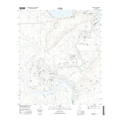
2016 Map of Kingsland
USGS Topo · Published 2016About this map
Kingsland sits at the significant confluence of the Colorado River and the Llano River, serving as a focal point for the Texas Hill Country's waterway network. The landscape is defined by the managed waters of the Colorado, anchored to the north by the massive Buchanan Dam. This 2016 survey illustrates the extensive residential development and road networks that have grown around these river systems, reflecting the area's evolution into a premier lake-front community. The map provides a precise look at how the topography transitions from the structured settlement of Kingsland into the higher elevations near Buchanan Dam, documenting the relationship between the built environment and the region's prominent reservoirs and river bends.
Find a feature on this map
3 named features on this map. Tap any name to fly to it.
Don’t see what you’re looking for? This feature index may not catch every label — zoom into the map to look around manually.
Map Details
Editions of this 2016 Kingsland Map
This is the sole edition of this map. No revisions or reprints were ever made.
Other maps of this area

1887 · Llano
USGS Topo · 1:125,000

1887 · Burnet
USGS Topo · 1:125,000

1893 · Burnet
USGS Topo · 1:125,000

1894 · Llano
USGS Topo · 1:125,000

1903 · Burnet
USGS Topo · 1:125,000

1904 · Llano
USGS Topo · 1:125,000

1909 · Llano
USGS Topo · 1:125,000

1909 · Burnet
USGS Topo · 1:125,000

1918 · Llano
USGS Topo · 1:125,000

1925 · Burnet 3-b
USGS Topo · 1:48,000