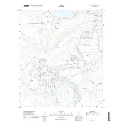
2019 Map of Kingsland
USGS Topo · Published 2019About this map
Kingsland sits at the confluence of the Llano River and the Colorado River, a landscape defined by the expansive waters of Lake Buchanan and Kingsland Lake. This 2019 survey captures the developed character of the Llano County and Burnet County border, where local transportation is facilitated by the State Highway 29 Bridge and a network of ranch roads like Ranch Rd 261. The area's history is preserved in sites such as Kingsland Cem, Murchison Cem, and the Hoovers Valley Cem near the settlement of Hoovers Valley. The terrain rises toward Backbone Mtn and Long Mtn, overlooking a region marked by recreational and aviation hubs including Camp Longhorn-Airport and the Shirley Williams Airport. This documentation reflects the contemporary balance between residential growth, small-scale aviation, and the enduring granite-and-water geography of the Texas Hill Country.
Find a feature on this map
57 named features on this map. Tap any name to fly to it.
Don’t see what you’re looking for? This feature index may not catch every label — zoom into the map to look around manually.
Map Details
Editions of this 2019 Kingsland Map
This is the sole edition of this map. No revisions or reprints were ever made.
Other maps of this area

1887 · Llano
USGS Topo · 1:125,000

1887 · Burnet
USGS Topo · 1:125,000

1893 · Burnet
USGS Topo · 1:125,000

1894 · Llano
USGS Topo · 1:125,000

1903 · Burnet
USGS Topo · 1:125,000

1904 · Llano
USGS Topo · 1:125,000

1909 · Llano
USGS Topo · 1:125,000

1909 · Burnet
USGS Topo · 1:125,000

1918 · Llano
USGS Topo · 1:125,000

1925 · Burnet 3-b
USGS Topo · 1:48,000