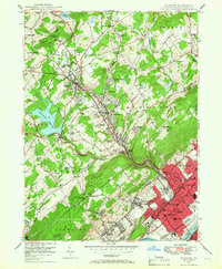
1946 Map of Kingston
USGS Topo · Published 1966About this map
The Susquehanna River flows past a densely developed valley where the industrial and educational heart of the region beat just after the war. In the southeastern corner, the borough of Kingston stands as a hub of civic life, anchored by the Wyoming Seminary and the Nesbitt Memorial Hospital. The landscape transitions from the riverfront urbanization of Swoyersville and Forty Fort into the rising elevations of the Back Mountain area. Here, institutional landmarks like Misericordia College and the Irem Temple Country Club define the character of Dallas. The infrastructure of the era is evident in the path of the Lehigh Valley railroad and the Connecting RR, which supported the valley's economy. High on the ridges, the Harvey Lookout Tower overlooks a terrain marked by early strip mining and the expansive Huntsville Reservoir, reflecting the intersection of natural resources and growing suburban settlements.
Find a feature on this map
81 named features on this map. Tap any name to fly to it.
Don’t see what you’re looking for? This feature index may not catch every label — zoom into the map to look around manually.
Map Details
Editions of this 1946 Kingston Map
5 editions found
Other maps of this area

1891 · Wilkesbarre
USGS Topo · 1:62,500

1891 · Harveys Lake
USGS Topo · 1:62,500

1893 · Harvey Lake
USGS Topo · 1:62,500

1893 · Pittston
USGS Topo · 1:62,500

1894 · Shickshinny
USGS Topo · 1:62,500

1894 · Wilkesbarre
USGS Topo · 1:62,500

1943 · Scranton
USGS Topo · 1:125,000

1946 · Nanticoke
USGS Topo · 1:31,680

1946 · Kingston
USGS Topo · 1:24,000

1946 · Harveys Lake
USGS Topo · 1:24,000