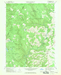
1967 Map of Kingwood
USGS Topo · Published 1970About this map
Laurel Hill dominates the western half of this Somerset County landscape, where the high ridgeline of Forbes State Forest descends into the valleys of Middle Creek and the Casselman River. In the late 1960s, this area retained a distinctly rural character, defined by small settlements like Scullton, Barronvale, and Kingwood. The map reveals an active extraction economy with numerous strip mines dotting the hillsides, particularly around Metzler.
Find a feature on this map
56 named features on this map. Tap any name to fly to it.
Don’t see what you’re looking for? This feature index may not catch every label — zoom into the map to look around manually.
Map Details
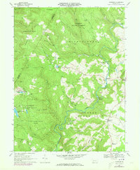
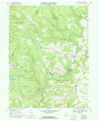
Editions of this 1967 Kingwood Map
3 editions found
Other maps of this area

1913 · Somerset
USGS Topo · 1:62,500

1915 · Somerset
USGS Topo · 1:62,500

1921 · Meyersdale
USGS Topo · 1:62,500

1922 · Confluence
USGS Topo · 1:62,500

1922 · Donegal
USGS Topo · 1:62,500

1931 · Confluence
USGS Topo · 1:62,500

1933 · Confluence
USGS Topo · 1:62,500

1935 · Donegal
USGS Topo · 1:62,500

1939 · Meyersdale
USGS Topo · 1:62,500

1944 · Somerset
USGS Topo · 1:62,500
Featured Places
- Springfield Township, PA
- Saltlick Township, PA
- Upper Turkeyfoot Township, PA
- Lower Turkeyfoot Township, PA
- Metzler, Upper Turkeyfoot Township