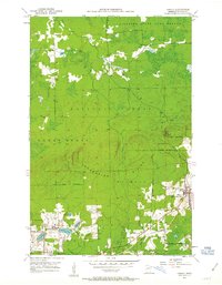
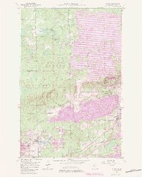
1951 Map of Kinney
USGS Topo · Published 1963About this map
Industrial activity on the Mesabi Range is the defining characteristic of this 1951 survey, where the extraction of iron ore has physically reshaped the landscape. The iron mining operations are concentrated heavily in the southern half of the map, notably around Mountain Iron and the village of Kinney. Large open pits and extensive Mine Dumps surround the Mountain Iron Mine, Atkins Mine, and Wade Mine, illustrating the massive scale of earth-moving required during this peak era of production. North of the Laurentian Divide, the terrain shifts abruptly from industrial excavations to the dense woodlands of the Superior National Forest and the Superior State Game Refuge. In this northern sector, the land remains largely undeveloped, drained by Slow Creek and the Dark River. Local landmarks like the Anderson Sch and the Great Northern railroad tracks provide vital context for researchers tracing the historical development of these mining communities.
Find a feature on this map
33 named features on this map. Tap any name to fly to it.
Don’t see what you’re looking for? This feature index may not catch every label — zoom into the map to look around manually.
Map Details
Editions of this 1951 Kinney Map
7 editions found
Other maps of this area

1951 · Eveleth
USGS Topo · 1:24,000

1951 · Virginia
USGS Topo · 1:24,000

1951 · Kinney
USGS Topo · 1:24,000

1951 · Kirk
USGS Topo · 1:24,000

1951 · Britt
USGS Topo · 1:24,000

1951 · Buhl
USGS Topo · 1:24,000

1952 · Idington
USGS Topo · 1:24,000

1954 · Hibbing
USGS Topo · 1:250,000

1955 · Dark Lake
USGS Topo · 1:24,000

1955 · Dewey Lake SE
USGS Topo · 1:24,000