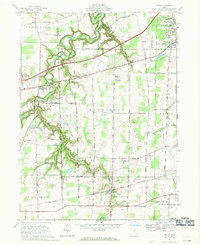
1969 Map of Kipton
USGS Topo · Published 1971About this map
Kipton and its surrounding agricultural townships appear in this 1969 survey during a period of infrastructure expansion in northern Ohio. The Vermilion River carves a deep, winding path through the western portion of the quadrangle, passing near Birmingham and the Firelands Community Park. To the north and east, the industrial influence of quarrying is evident near South Amherst, while the rural landscape is crisscrossed by established thoroughfares like Gore Orphanage Road and the Ohio Turnpike. Local education and aviation are prominent features of the area, with the Firelands High Sch campus and small airfields like Ostner Airport and Oberlin Airport serving the local community. The presence of the Penn Central rail line running through Kipton highlights the village's historic role as a rail-centered settlement, while the Kipton Reservoir and numerous local cemeteries like Harrison Cem provide essential genealogical and geographical landmarks for those tracing the development of Lorain and Erie counties.
Find a feature on this map
58 named features on this map. Tap any name to fly to it.
Don’t see what you’re looking for? This feature index may not catch every label — zoom into the map to look around manually.
Map Details
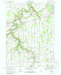
Editions of this 1969 Kipton Map
2 editions found
Other maps of this area

1901 · Oberlin
USGS Topo · 1:62,500

1903 · Vermilion
USGS Topo · 1:62,500

1903 · Oberlin
USGS Topo · 1:62,500

1904 · Wellington
USGS Topo · 1:62,500

1906 · Wellington
USGS Topo · 1:62,500

1908 · New London
USGS Topo · 1:62,500

1956 · Toledo
USGS Topo · 1:250,000

1959 · Berlin Heights
USGS Topo · 1:24,000

1959 · Vermilion East
USGS Topo · 1:24,000

1959 · Vermilion West
USGS Topo · 1:24,000