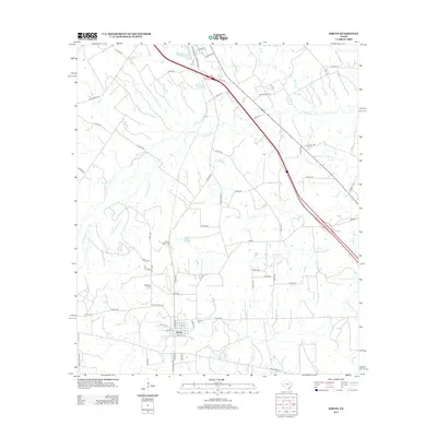
2013 Map of Kirvin
USGS Topo · Published 2013About this map
Kirvin sits at the southern edge of this East Texas landscape, where local life is tied to a network of creeks and small family cemeteries. The terrain is defined by the branching waters of Tehuacana Cr and Little Tehuacana Cr, which carve through the countryside north and west of the settlement. For genealogists and local historians, the map preserves the locations of several burial sites, including Webb Branch Cem, Woodland Cem, and Session Cem, providing a spatial record of the area's rural heritage.
Find a feature on this map
62 named features on this map. Tap any name to fly to it.
Don’t see what you’re looking for? This feature index may not catch every label — zoom into the map to look around manually.
Map Details
Editions of this 2013 Kirvin Map
This is the sole edition of this map. No revisions or reprints were ever made.
Other maps of this area

1919 · Fairfield
USGS Topo · 1:62,500

1920 · Mexia
USGS Topo · 1:62,500

1954 · Waco
USGS Topo · 1:250,000

1955 · Waco
USGS Topo · 1:250,000

1960 · Winkler
USGS Topo · 1:24,000

1960 · Streetman
USGS Topo · 1:24,000

1963 · Richland
USGS Topo · 1:24,000

1963 · Wortham
USGS Topo · 1:24,000

1963 · Teague North
USGS Topo · 1:24,000

1963 · Kirvin
USGS Topo · 1:24,000