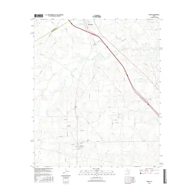
2016 Map of Kirvin
USGS Topo · Published 2016About this map
Streetman and Kirvin anchor this portion of the Texas prairie, where the Navarro Co and Freestone Co line divides the landscape. This 2016 survey illustrates a rural environment defined by winding watercourses like Tehuacana Cr and Little Tehuacana Cr, which snake through the terrain alongside substantial ponds such as Streetman Lake and Loper Lake. For family historians, the map is a critical record of local burials, specifically marking Cedar Grove Cem to the north and Session Cem near the Kirvin townsite. The street grid of Kirvin is clearly delineated with local names like Shumate St and Pecan St, while the surrounding area is tied together by a network of ranch-to-market and county roads including FM 80 and Ranch Rd 246, showing how these communities maintain their connection to the land and each other.
Find a feature on this map
61 named features on this map. Tap any name to fly to it.
Don’t see what you’re looking for? This feature index may not catch every label — zoom into the map to look around manually.
Map Details
Editions of this 2016 Kirvin Map
This is the sole edition of this map. No revisions or reprints were ever made.
Other maps of this area

1919 · Fairfield
USGS Topo · 1:62,500

1920 · Mexia
USGS Topo · 1:62,500

1954 · Waco
USGS Topo · 1:250,000

1955 · Waco
USGS Topo · 1:250,000

1960 · Winkler
USGS Topo · 1:24,000

1960 · Streetman
USGS Topo · 1:24,000

1963 · Richland
USGS Topo · 1:24,000

1963 · Wortham
USGS Topo · 1:24,000

1963 · Teague North
USGS Topo · 1:24,000

1963 · Kirvin
USGS Topo · 1:24,000