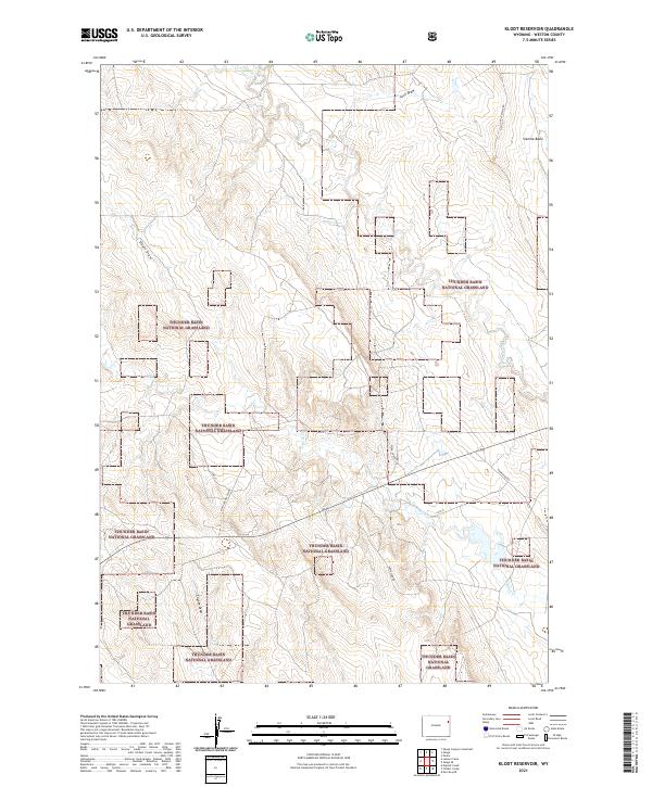
2021 Map of Klodt Reservoir
USGS Topo · Published 2021About this map
Thunder Basin National Grassland dominates this section of the Wyoming high plains, showing a complex mosaic of public lands and intermittent watercourses. The landscape is defined by the drainage patterns of Beaver Cr, Fiddler Cr, and Mush Cr, which carve through the dry terrain alongside named topographic features like Sixmile Basin and Luce Draw. This 2021 survey illustrates how the region's transport network remains tied to these natural contours and property boundaries.
Find a feature on this map
17 named features on this map. Tap any name to fly to it.
Don’t see what you’re looking for? This feature index may not catch every label — zoom into the map to look around manually.
Map Details
Editions of this 2021 Klodt Reservoir Map
This is the sole edition of this map. No revisions or reprints were ever made.
Other maps of this area

1899 · Newcastle
USGS Topo · 1:125,000

1901 · Newcastle
USGS Topo · 1:125,000

1951 · Morrisey NE
USGS Topo · 1:24,000

1951 · Osage SE
USGS Topo · 1:24,000

1955 · Newcastle
USGS Topo · 1:250,000

1958 · Newcastle
USGS Topo · 1:250,000
1972 · Pedro
USGS Topo · 1:24,000
1972 · Osage
USGS Topo · 1:24,000
1972 · Klodt Reservoir
USGS Topo · 1:24,000

1979 · Newcastle
USGS Topo · 1:100,000