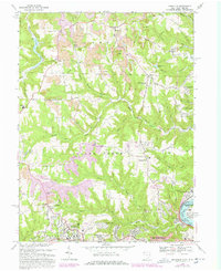
1968 Map of Knoxville
USGS Topo · Published 1978About this map
Industrial development and rural Jefferson County landscapes converge along the Ohio River in this detailed survey. Extensive Strip Mine operations are visible across the hills of Knox and Island Creek, documenting the significant impact of the coal industry on the local topography during the mid-20th century. In the south, the suburban growth of Wintersville and Overlook Hills stands in contrast to the northern agricultural sections and smaller settlements like Knoxville and Taylortown.
Find a feature on this map
63 named features on this map. Tap any name to fly to it.
Don’t see what you’re looking for? This feature index may not catch every label — zoom into the map to look around manually.
Map Details
Editions of this 1968 Knoxville Map
Other maps of this area

1901 · Cadiz
USGS Topo · 1:62,500

1903 · Cadiz
USGS Topo · 1:62,500

1904 · Wellsville
USGS Topo · 1:62,500

1904 · Steubenville
USGS Topo · 1:62,500

1905 · Salineville
USGS Topo · 1:62,500

1935 · Steubenville
USGS Topo · 1:62,500

1937 · Wellsville
USGS Topo · 1:62,500

1942 · Steubenville
USGS Topo · 1:62,500

1944 · Wellsville
USGS Topo · 1:62,500

1951 · Canton
USGS Topo · 1:250,000