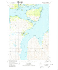
1947 Map of Kodiak D-3
USGS Topo · Published 1979About this map
Port Lions serves as the primary coastal settlement in this 1947 study of the northern Kodiak archipelago, showing a village infrastructure that includes a Wharf, Power Sta, and Tank. The maritime character of the region is defined by the complex waterways of Whale Passage and Kizhuyak Bay, where transportation relied heavily on the water as evidenced by the Seaplane Landing and a remote Landing Strip.
Find a feature on this map
65 named features on this map. Tap any name to fly to it.
Don’t see what you’re looking for? This feature index may not catch every label — zoom into the map to look around manually.
Map Details
Editions of this 1947 Kodiak D-3 Map
3 editions found
Other maps of this area

1947 · Kodiak D-3
USGS Topo · 1:63,360

1949 · Kodiak C-2
USGS Topo · 1:63,360

1949 · Kodiak D-2
USGS Topo · 1:63,360

1949 · Kodiak D-3
USGS Topo · 1:63,360

1950 · Kodiak D-3
USGS Topo · 1:63,360

1951 · Kodiak D-2
USGS Topo · 1:63,360

1952 · Kodiak
USGS Topo · 1:250,000

1952 · Afognak
USGS Topo · 1:250,000

1952 · Kodiak C-3
USGS Topo · 1:63,360

1952 · Afognak A-4
USGS Topo · 1:63,360