
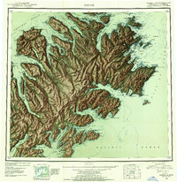
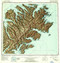
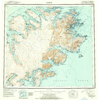
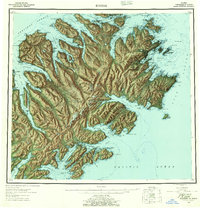
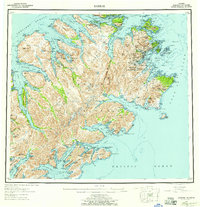
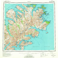
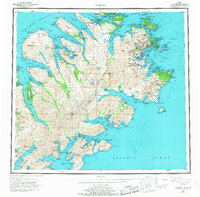
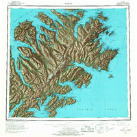
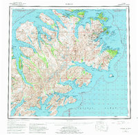
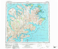
1952 Map of Kodiak
USGS Topo · Published 1953This historical map portrays the area of Kodiak in 1952, primarily covering Kodiak Island Borough. Featuring a scale of 1:250000, this map provides a highly detailed snapshot of the terrain, roads, buildings, counties, and historical landmarks in the Kodiak region at the time. Published in 1953, it is one of 12 known editions of this map due to revisions or reprints.
Find a feature on this map
131 named features on this map. Tap any name to fly to it.
Don’t see what you’re looking for? This feature index may not catch every label — zoom into the map to look around manually.
Map Details
Editions of this 1952 Kodiak Map
12 editions found
1953 edition
21.4 x 22 inches
1953 edition
21.3 x 22 inches
1954 edition
21.1 x 22.1 inches
1954 edition
21.5 x 21.9 inches
1957 edition
21.2 x 22 inches
1957 edition
21.3 x 22 inches
1964 edition
22.1 x 21.9 inches
1968 edition
22.3 x 22 inches
1968 edition
22.1 x 22.1 inches
1980 edition
22.6 x 22.1 inches
1983 edition
26.5 x 22.5 inches
1983 edition
27.38 x 23.45 inches
Historical Maps of Old Harbor Through Time
1 maps found