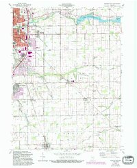
1960 Map of Kokomo East
USGS Topo · Published 1994About this map
Kokomo expands eastward across this 1960 topographic survey, revealing the city's mid-century residential and industrial footprint. The landscape is defined by the Wildcat Creek drainage system, which feeds into the Kokomo Waterworks Reservoir No 2 and Reservoir No 1. These water resources supported the growing urban core, where several education and faith centers appear, including Studebaker Sch, St Joan of Arc Sch, and Darrongh Chapel.
Find a feature on this map
37 named features on this map. Tap any name to fly to it.
Don’t see what you’re looking for? This feature index may not catch every label — zoom into the map to look around manually.
Map Details
Editions of this 1960 Kokomo East Map
3 editions found
Other maps of this area

1953 · Danville
USGS Topo · 1:250,000

1953 · Muncie
USGS Topo · 1:250,000

1955 · Danville
USGS Topo · 1:250,000

1956 · Muncie
USGS Topo · 1:250,000

1956 · Danville
USGS Topo · 1:250,000

1959 · Galveston
USGS Topo · 1:24,000

1959 · Miami
USGS Topo · 1:24,000

1960 · Kokomo West
USGS Topo · 1:24,000

1960 · Kokomo East
USGS Topo · 1:24,000

1960 · Kempton
USGS Topo · 1:24,000