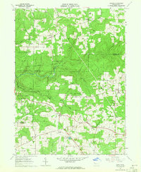
1963 Map of Kossuth
USGS Topo · Published 1965About this map
Kossuth and its surrounding rural hamlets are mapped here during the early 1960s, revealing a landscape defined by traditional crossroads communities and active natural resource extraction. The area's social fabric is visible through landmarks like Fertigs Gospel Tabernacle and St Marks Ch, while its industrial character is punctuated by a Strip Mine and numerous oil and gas wells. This survey illustrates the dense network of small family burial grounds, including Hickman Cem, Craig Cem, and Old Dutch Cem, which provide significant data for genealogical research.
Find a feature on this map
48 named features on this map. Tap any name to fly to it.
Don’t see what you’re looking for? This feature index may not catch every label — zoom into the map to look around manually.
Map Details
Editions of this 1963 Kossuth Map
3 editions found
Other maps of this area

1906 · Clarion
USGS Topo · 1:62,500

1907 · Clarion
USGS Topo · 1:62,500

1907 · Foxburg
USGS Topo · 1:62,500

1908 · Foxburg
USGS Topo · 1:62,500

1922 · Oil City
USGS Topo · 1:48,000

1922 · Tionesta
USGS Topo · 1:62,500

1924 · Oil City
USGS Topo · 1:62,500

1924 · Tionesta
USGS Topo · 1:62,500

1943 · Oil City
USGS Topo · 1:62,500

1946 · Tionesta
USGS Topo · 1:62,500
Featured Places
- Cranberry Township, PA
- Rockland Township, PA
- Powell Corners, Pinegrove Township
- Ashland Township, PA
- Richland Township, PA