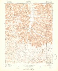
1953 Map of Kossuth
USGS Topo · Published 1954About this map
Kossuth and Plattsburg anchor the northern reaches of this mid-century Washington County landscape, where deep hollows and narrow ridges define the local settlement patterns. The terrain is marked by distinctive landforms like Tater Knob and Clay Hill, while the drainage network follows narrow corridors such as Winslow Hollow and Mandy Hollow. This survey captures the rural infrastructure of the early 1950s, showing a high density of community centers including the Pleasant View Sch and Blue River Sch, alongside numerous small burial grounds like Collett Cem and Nicholson Cem.
Find a feature on this map
35 named features on this map. Tap any name to fly to it.
Don’t see what you’re looking for? This feature index may not catch every label — zoom into the map to look around manually.
Map Details
Editions of this 1953 Kossuth Map
3 editions found
Other maps of this area

1950 · Salem
USGS Topo · 1:24,000

1950 · Becks Mill
USGS Topo · 1:24,000

1951 · Smedley
USGS Topo · 1:24,000

1953 · Kossuth
USGS Topo · 1:24,000

1955 · South Boston
USGS Topo · 1:24,000

1956 · Vincennes
USGS Topo · 1:250,000

1956 · Louisville
USGS Topo · 1:250,000

1957 · Vincennes
USGS Topo · 1:250,000

1958 · Vincennes
USGS Topo · 1:250,000

1958 · Little York
USGS Topo · 1:24,000