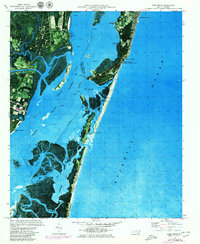
1970 Map of Kure Beach
USGS Topo · Published 1980About this map
Fort Fisher State Historic Site anchors the narrow peninsula where the Cape Fear River meets the Atlantic Ocean. This 1970 orthophotomap, updated in 1979, illustrates the complex hydrography of the Lower Cape Fear, including the significant engineering of The Rocks and the passage through Snows Cut. The presence of the Military Ocean Terminal and Fort Fisher Air Force Sta reflects the strategic Cold War importance of this coastline.
Find a feature on this map
41 named features on this map. Tap any name to fly to it.
Don’t see what you’re looking for? This feature index may not catch every label — zoom into the map to look around manually.
Map Details
Editions of this 1970 Kure Beach Map
2 editions found
Other maps of this area

1942 · Wilmington
USGS Topo · 1:62,500

1942 · Cape Fear
USGS Topo · 1:24,000

1943 · Funston
USGS Topo · 1:24,000

1946 · Southport
USGS Topo · 1:24,000

1946 · Snow Marsh
USGS Topo · 1:24,000

1948 · Wilmington
USGS Topo · 1:62,500

1949 · Georgetown
USGS Topo · 1:250,000

1953 · Florence
USGS Topo · 1:250,000

1953 · Beaufort
USGS Topo · 1:250,000

1954 · Florence
USGS Topo · 1:250,000