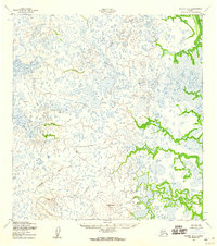
1952 Map of Kwiguk B-5
USGS Topo · Published 1959About this map
Ungulungwak Hill rises as a prominent landmark amidst the intricate labyrinth of wetlands and watercourses in this portion of the Yukon-Kuskokwim Delta. Surveyed in the early 1950s, the landscape is defined by the sinuous path of Igokluk Slough and the broader waters of Anakehek Pass. The terrain is characterized by a dense network of unnamed thaw lakes and marshes, typical of the subarctic tundra, where navigable waterways like the Ponglevik River and Pikmiktalik Slough served as the primary transit corridors. Geodetic control points such as VABM Berry and VABM Last underscore the methodical efforts of the Army Map Service to document this remote coastal region. This map illustrates a specific moment in the mid-20th century before significant environmental shifts altered the delicate drainage patterns of the delta.
Find a feature on this map
7 named features on this map. Tap any name to fly to it.
Don’t see what you’re looking for? This feature index may not catch every label — zoom into the map to look around manually.
Map Details
Editions of this 1952 Kwiguk B-5 Map
2 editions found
Other maps of this area

1952 · Kwiguk
USGS Topo · 1:250,000

1952 · Kwiguk A-5
USGS Topo · 1:63,360

1952 · Kwiguk C-6
USGS Topo · 1:63,360

1952 · Kwiguk B-6
USGS Topo · 1:63,360

1952 · Kwiguk A-6
USGS Topo · 1:63,360

1952 · Kwiguk B-5
USGS Topo · 1:63,360

1952 · Kwiguk C-4
USGS Topo · 1:63,360

1952 · Kwiguk A-4
USGS Topo · 1:63,360

1952 · Kwiguk C-5
USGS Topo · 1:63,360

1952 · Kwiguk B-4
USGS Topo · 1:63,360