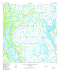
1952 Map of Kwiguk C-4
USGS Topo · Published 1981About this map
The Yukon River divides into a complex network of waterways within the Yukon Delta National Wildlife Refuge in this 1950s-era topography. This deltaic landscape is dominated by the broad Kwikpak Pass, where the river reaches the Head of Passes and fans out into a maze of smaller channels like Okfauchavuk Slough and Nanvaranak Slough. The intricate pattern of wetlands and seasonal ponds is punctuated by the large Nanvaranak Lake to the east.
Find a feature on this map
13 named features on this map. Tap any name to fly to it.
Don’t see what you’re looking for? This feature index may not catch every label — zoom into the map to look around manually.
Map Details
Editions of this 1952 Kwiguk C-4 Map
2 editions found
Other maps of this area

1952 · Kwiguk
USGS Topo · 1:250,000

1952 · Kwiguk B-3
USGS Topo · 1:63,360

1952 · Kwiguk D-3
USGS Topo · 1:63,360

1952 · Kwiguk C-3
USGS Topo · 1:63,360

1952 · Kwiguk B-5
USGS Topo · 1:63,360

1952 · Kwiguk C-4
USGS Topo · 1:63,360

1952 · Kwiguk C-5
USGS Topo · 1:63,360

1952 · Kwiguk D-5
USGS Topo · 1:63,360

1952 · Kwiguk B-4
USGS Topo · 1:63,360

1952 · Kwiguk D-4
USGS Topo · 1:63,360