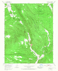
1953 Map of La Madera
USGS Topo · Published 1968About this map
Vallecitos and La Madera anchor this mid-century look at the Rio Arriba mining landscape, where the Rio Vallecitos carves a path through the Carson National Forest. The geography is defined by the Mesa de la Jarita and the Madera Mountains, serving as a backdrop for an active extraction economy. Multiple mining operations are documented in detail, including active sites like the Sunnyside Mine, Triple E Mine, and Guadalupe Mine.
Find a feature on this map
50 named features on this map. Tap any name to fly to it.
Don’t see what you’re looking for? This feature index may not catch every label — zoom into the map to look around manually.
Map Details
Editions of this 1953 La Madera Map
3 editions found
Other maps of this area

1918 · Abiquiu
USGS Topo · 1:125,000

1918 · Tusas
USGS Topo · 1:125,000

1953 · Valle Grande Peak
USGS Topo · 1:24,000

1953 · El Rito
USGS Topo · 1:24,000

1953 · La Madera
USGS Topo · 1:24,000

1953 · Ojo Caliente
USGS Topo · 1:24,000

1954 · Raton
USGS Topo · 1:250,000

1954 · Aztec
USGS Topo · 1:250,000

1958 · Raton
USGS Topo · 1:250,000

1958 · Aztec
USGS Topo · 1:250,000