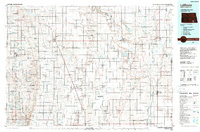
1986 Map of La Moure
USGS Topo · Published 1989About this map
The James River Valley defines the eastern geography of this 1980s landscape, where the river winds southward through Grand Rapids and past the county seat of LaMoure. This era shows a region deeply integrated with conservation and water management, evidenced by the expansive National Waterfowl Production Area and several reservoirs including Lake LaMoure and the Schlecht-Thom Dam. The rail networks of the Soo Line and Burlington Northern connect agricultural hubs like Edgeley, Ellendale, and Oakes, illustrating the transport-dependent economy of the Dakota plains.
Find a feature on this map
108 named features on this map. Tap any name to fly to it.
Don’t see what you’re looking for? This feature index may not catch every label — zoom into the map to look around manually.
Map Details
Editions of this 1986 La Moure Map
2 editions found
Other maps of this area

1894 · Monango
USGS Topo · 1:62,500

1894 · La Moure
USGS Topo · 1:62,500

1894 · Ellendale
USGS Topo · 1:62,500

1894 · Hecla
USGS Topo · 1:62,500

1894 · Savo
USGS Topo · 1:62,500

1894 · Fullerton
USGS Topo · 1:62,500

1894 · Oakes
USGS Topo · 1:62,500

1895 · Lamoure
USGS Topo · 1:125,000

1896 · Columbia
USGS Topo · 1:125,000

1896 · Jamestown
USGS Topo · 1:125,000