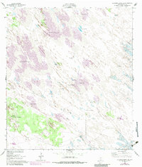
1952 Map of La Parra Ranch SE
USGS Topo · Published 1982About this map
Shifting Sand Dunes dominate this stretch of Kenedy County, where water is the primary resource for life and industry. Originally mapped by the U.S. Coast and Geodetic Survey in 1950 and updated with 1975 aerial photography, the landscape is defined by its scattered ranching infrastructure and reliance on subterranean water. Locations like Los Indios Ranch and Santa Elena Trap serve as focal points for local ranching operations. The area is dotted with numerous vital water sources, ranging from the Aguion Well (Windmill) and Chaparral Windmill to deeper taps like the Sarita Artesian Well and Ramirez Artesian Well. The presence of a Pipeline cutting through the dunes indicates the mid-century industrial expansion into this sparsely populated region, while family-named sites like San Juan Artesian Well provide valuable leads for genealogists tracing local land use.
Find a feature on this map
20 named features on this map. Tap any name to fly to it.
Don’t see what you’re looking for? This feature index may not catch every label — zoom into the map to look around manually.
Map Details
Editions of this 1952 La Parra Ranch SE Map
3 editions found
Other maps of this area

1923 · Lopena Island
USGS Topo · 1:62,500

1923 · Saltillo Ranch
USGS Topo · 1:62,500

1928 · Sarita
USGS Topo · 1:125,000

1950 · Corpus Christi
USGS Topo · 1:250,000

1951 · Potrero Lopeno NW
USGS Topo · 1:24,000

1951 · Sarita 4 NE
USGS Topo · 1:24,000

1952 · Potrero Cortado
USGS Topo · 1:24,000

1952 · La Parra Ranch
USGS Topo · 1:24,000

1952 · Yarborough Pass
USGS Topo · 1:24,000

1952 · Sarita 4 SE
USGS Topo · 1:24,000