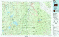
1986 Map of La Pine
USGS Topo · Published 1987About this map
The high desert and volcanic highlands of Central Oregon are mapped here in the mid-1980s, centered on the growing community of La Pine. The landscape is dominated by the massive Newberry Crater to the east and the water systems of the Deschutes River and Little Deschutes River to the west. This period shows the established recreational and residential hubs of Sunriver and Gilchrist amidst the extensive timberlands of the Deschutes National Forest.
Find a feature on this map
36 named features on this map. Tap any name to fly to it.
Don’t see what you’re looking for? This feature index may not catch every label — zoom into the map to look around manually.
Map Details
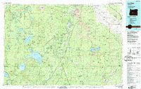
Editions of this 1986 La Pine Map
2 editions found
Other maps of this area

1917 · Diamond Lake
USGS Topo · 1:125,000

1925 · Waldo Lake
USGS Topo · 1:125,000

1926 · Bend
USGS Topo · 1:125,000

1929 · Bend
USGS Topo · 1:125,000

1929 · Three Sisters
USGS Topo · 1:125,000

1930 · Maiden Peak
USGS Topo · 1:125,000

1931 · Newberry Crater
USGS Topo · 1:125,000

1932 · Three Sisters
USGS Topo · 1:125,000

1934 · Maiden Peak
USGS Topo · 1:125,000

1934 · Mc Kenzie Bridge
USGS Topo · 1:96,000