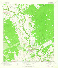
1962 Map of La Vernia
USGS Topo · Published 1963About this map
Cibolo Creek defines the lower-elevation landscape of this central Texas region, winding between the settlements of La Vernia and Sutherland Springs. The 1960s terrain is marked by petroleum exploration and extraction, notably at the Linne Oil Field and the Sutherland Springs Oil Field, which speak to the industrial character of the era. Transportation history is etched into the land via the Old Railroad Grade and numerous Jeep Trails that traverse the denser wooded uplands to the east.
Find a feature on this map
15 named features on this map. Tap any name to fly to it.
Don’t see what you’re looking for? This feature index may not catch every label — zoom into the map to look around manually.
Map Details
Editions of this 1962 La Vernia Map
2 editions found
Other maps of this area

1920 · Smiley
USGS Topo · 1:125,000

1936 · Floresville
USGS Topo · 1:62,500

1942 · Dewville
USGS Topo · 1:62,500

1953 · Seguin
USGS Topo · 1:250,000

1954 · San Antonio
USGS Topo · 1:250,000

1956 · Dewville
USGS Topo · 1:62,500

1957 · San Antonio
USGS Topo · 1:250,000

1957 · New Berlin
USGS Topo · 1:24,000

1958 · Seguin
USGS Topo · 1:250,000

1958 · La Vernia SW
USGS Topo · 1:24,000