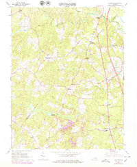
1966 Map of Ladysmith
USGS Topo · Published 1979About this map
Ladysmith and its surrounding rural countryside in Spotsylvania and Caroline Counties appear here in a state of late-twentieth-century development. The landscape is defined by the branching tributaries of the Matta River, Mat River, Motto River, and South River, which historically dictated the placement of early infrastructure like Colemans Mill and Temples Millpond. The settlement pattern is characterized by numerous named crossroads, such as Blades Corner, Nancy Wrights Corner, and Ryland Corner, many of which likely evolved around family-owned homesteads and local commerce.
Find a feature on this map
27 named features on this map. Tap any name to fly to it.
Don’t see what you’re looking for? This feature index may not catch every label — zoom into the map to look around manually.
Map Details
Editions of this 1966 Ladysmith Map
4 editions found
Other maps of this area

1887 · Spottsylvania
USGS Topo · 1:125,000

1889 · Fredericksburg
USGS Topo · 1:125,000

1890 · Goochland
USGS Topo · 1:125,000

1892 · Fredericksburg
USGS Topo · 1:125,000

1892 · Spottsylvania
USGS Topo · 1:125,000

1892 · Goochland
USGS Topo · 1:125,000

1894 · Fredericksburg
USGS Topo · 1:125,000

1918 · Doswell
USGS Topo · 1:62,500

1942 · Woodford
USGS Topo · 1:31,680

1942 · Guinea
USGS Topo · 1:31,680