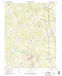
1966 Map of Ladysmith
USGS Topo · Published 1979About this map
Ladysmith and its surrounding rural corridors in Caroline County are defined by a network of family-named intersections and water-driven history along the Matta River and South River. As of the mid-1960s, the landscape remained largely agricultural, anchored by community landmarks such as Colemans Mill and Smith High Sch. The map preserves the location of numerous country churches, including Rehoboth Ch, Beulah Ch, and Wrights Chapel, which served as social anchors for the dispersed farmsteads.
Find a feature on this map
32 named features on this map. Tap any name to fly to it.
Don’t see what you’re looking for? This feature index may not catch every label — zoom into the map to look around manually.
Map Details
Editions of this 1966 Ladysmith Map
4 editions found
Other maps of this area

1887 · Spottsylvania
USGS Topo · 1:125,000

1889 · Fredericksburg
USGS Topo · 1:125,000

1890 · Goochland
USGS Topo · 1:125,000

1892 · Fredericksburg
USGS Topo · 1:125,000

1892 · Spottsylvania
USGS Topo · 1:125,000

1892 · Goochland
USGS Topo · 1:125,000

1894 · Fredericksburg
USGS Topo · 1:125,000

1918 · Doswell
USGS Topo · 1:62,500

1942 · Woodford
USGS Topo · 1:31,680

1942 · Guinea
USGS Topo · 1:31,680