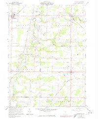
1960 Map of Lagrange
USGS Topo · Published 1974About this map
East Branch Black River winds through this portion of the Connecticut Western Reserve, defining a landscape where agriculture meets industrial extraction. By the early 1960s, the terrain south of Lagrange and Belden was dotted with numerous gas and oil wells, most notably within the Preston Oil Field in the southern reaches of the quadrangle. The influence of the extractive industry is mirrored by a dense network of transportation, where heavy rail lines like the Baltimore and Ohio and the Akron Canton and Youngstown intersect near Litchfield. Rural life remains anchored by established landmarks such as the Penfield Ch and several family burying grounds, including Knowles Cem and Aldrich Cem. The appearance of the Meadow Aire Farm Airport highlights the mid-century integration of private aviation into the traditional farming landscape of Penfield and Grafton townships.
Find a feature on this map
43 named features on this map. Tap any name to fly to it.
Don’t see what you’re looking for? This feature index may not catch every label — zoom into the map to look around manually.
Map Details
Editions of this 1960 Lagrange Map
2 editions found
Other maps of this area

1901 · Oberlin
USGS Topo · 1:62,500

1902 · Berea
USGS Topo · 1:62,500

1903 · Oberlin
USGS Topo · 1:62,500

1904 · Berea
USGS Topo · 1:62,500

1904 · Medina
USGS Topo · 1:62,500

1904 · Wellington
USGS Topo · 1:62,500

1906 · Medina
USGS Topo · 1:62,500

1906 · Wellington
USGS Topo · 1:62,500

1950 · Cleveland
USGS Topo · 1:250,000

1953 · West View
USGS Topo · 1:24,000