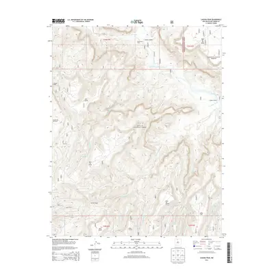
2013 Map of Laguna Peak
USGS Topo · Published 2013About this map
Laguna Peak anchors this corner of Rio Arriba County, where the high-altitude landscape is defined by the canyon systems and plateaus of the Santa Fe National Forest and Carson National Forest. The map captures a complex drainage network where Rio Gallina and Rio Chama carve through the earth, creating distinctive landforms like Mesa de los Viejos and the curiously named Screaming Left Hand Turn.
Find a feature on this map
41 named features on this map. Tap any name to fly to it.
Don’t see what you’re looking for? This feature index may not catch every label — zoom into the map to look around manually.
Map Details
Editions of this 2013 Laguna Peak Map
This is the sole edition of this map. No revisions or reprints were ever made.
Other maps of this area

1909 · Gallina
USGS Topo · 1:125,000

1940 · Cuba
USGS Topo · 1:62,500

1943 · Cuba
USGS Topo · 1:62,500

1953 · Alire
USGS Topo · 1:24,000

1953 · Echo Ampitheater
USGS Topo · 1:24,000

1953 · Arroyo Del Agua
USGS Topo · 1:24,000

1953 · Laguna Peak
USGS Topo · 1:24,000

1953 · Navajo Peak
USGS Topo · 1:24,000

1953 · Youngsville
USGS Topo · 1:24,000
1953 · Youngsville
USGS Topo · 1:62,500